
[Analysis] Motor Vehicle Collisions by Neighborhood: Milwaukee
At Mingo & Yankala S.C., we work with victims and families that have been impacted by motor vehicle collisions. For this reason, we have worked on creating several road safety resources to help motorists in Wisconsin understand the dangers on the road. This includes identifying the deadliest roads in Wisconsin, high collision intersections in Milwaukee, and providing resources on handling car accident insurance claims.
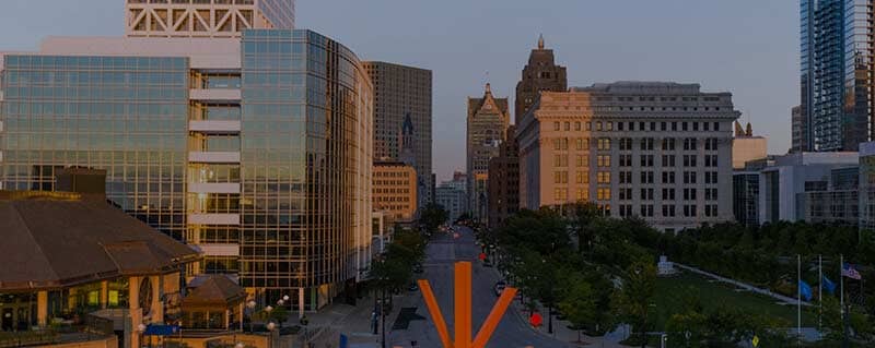
Today, we examine the collision risk in Milwaukee by neighborhood. Milwaukee is the largest city in Wisconsin and the 32nd most populous city in the United States (according to the 2020 U.S. Census). As with any major city, Milwaukee is made up of many unique neighborhoods and regions – a total of 189 of them according to data from the City of Milwaukee.
We worked with data visualization firm, 1Point21 Interactive, to identify which neighborhoods saw the most collisions, injuries, deaths, and alcohol-related crashes from 2018 – 2022.
Interactive Map: Which Milwaukee Neighborhood Has the Most Motor Vehicle Collisions?
Below is a list of the 20 Milwaukee neighborhoods with the most collisions from 2018 – 2022. Harambee is the neighborhood with the highest number of collisions, totaling 2,866. Old North Milwaukee and Menomonee River Valley follow closely with 2,630 and 2,459 collisions respectively. Amani and Walker’s Point round out the top five with 2,335 and 2,305 collisions each. Other neighborhoods that made the list include Kilbourn Town with 2,219 collisions, Sherman Park with 2,142 collisions, and Historic Mitchell Street with 1,995 collisions.
It’s interesting to note that many of the neighborhoods with the highest collision rates are also some of the most densely populated areas in the city, such as Lower East Side and Bay View. Juneau Town, Lincoln Village, and Capitol Heights are also in the top 20, showing that collisions are not just happening on busy streets and highways but also in residential neighborhoods.
The 20 Milwaukee Neighborhoods with the Most Collisions
- Harambee – 2,866
- Old North Milwaukee – 2,630
- Menomonee River Valley – 2,459
- Amani – 2,335
- Walker’s Point – 2,305
- Kilbourn Town – 2,219
- Sherman Park – 2,142
- Historic Mitchell Street – 1,995
- Lincoln Creek – 1,812
- Capitol Heights – 1,735
- Bay View – 1,630
- Lower East Side – 1,622
- Lincoln Village – 1,602
- Juneau Town – 1,595
- Franklin Heights – 1,515
- Silver Spring – 1,501
- Muskego Way – 1,488
- Roosevelt Grove – 1,454
- North Division – 1,441
- Avenues West – 1,421
Neighborhoods with the Most Fatal Collisions
Fatal crashes, of course, are the most serious type of traffic collision. Fortunately, they are also the rarest type. During the study period, there were a total of 324 fatal crashes in the observed neighborhoods.
- Old North Milwaukee – 12
- Amani – 12
- Capitol Heights – 11
- Menomonee River Valley – 10
- Roosevelt Grove – 10
- Lincoln Creek – 9
- Franklin Heights – 8
- Kilbourn Town – 8
- Silver Spring – 7
- Sherman Park – 7
Injuries and Fatalities
For Milwaukee overall, one in four crashes involved either an injury or death. However, 84 neighborhoods had rates above that. Of those that saw at least 50 total crashes, Havenwoods and Whispering Hills had the highest rate with 37 percent of all crashes involving a casualty. Of the
Alcohol-Related Crashes in Milwaukee
Just over 3,000 observed collisions were definitively identified as ‘alcohol-related’. The map below shows the data for all 189 neighborhoods.
The Ten Neighborhoods with the Most Alcohol-Related Crashes
- Menomonee River Valley – 108
- Walker’s Point – 102
- Bay View – 87
- Historic Mitchell Street – 80
- Juneau Town – 74
- Kilbourn Town – 69
- Lower East Side – 68
- Muskego Way – 67
- Lincoln Village – 64
- Old North Milwaukee – 63
When viewed as a percentage of all crashes, however, the list changes. Citywide, three percent of all crashes were considered to be alcohol-related.
Table: Data For All Milwaukee Neighborhoods
| Neighborhood | All Crashes | Injury Crashes | Fatal Crashes | Alcohol-Related |
|---|---|---|---|---|
| City Total | 94,750 | 23,211 | 324 | 3,058 |
| Alcott Park | 33 | 9 | 0 | 4 |
| Alverno | 80 | 21 | 0 | 2 |
| Amani | 2,335 | 718 | 12 | 52 |
| Arlington Gardens | 360 | 97 | 2 | 7 |
| Arlington Heights | 1,092 | 289 | 5 | 25 |
| Avenues West | 1,421 | 349 | 2 | 53 |
| Baran Park | 183 | 43 | 2 | 8 |
| Bay View | 1,630 | 317 | 6 | 87 |
| Bluemound Heights | 462 | 84 | 1 | 19 |
| Borchert Field | 424 | 97 | 1 | 10 |
| Bradley Estates | 143 | 34 | 0 | 6 |
| Brewer’s Hill | 266 | 53 | 0 | 3 |
| Brown Deer Park | 12 | 5 | 0 | 0 |
| Brynwood | 246 | 75 | 2 | 9 |
| Burnham Park | 892 | 194 | 2 | 35 |
| Calumet Farms | 269 | 77 | 3 | 8 |
| Cambridge Heights | 285 | 54 | 0 | 8 |
| Cannon Park | 323 | 62 | 0 | 10 |
| Capitol Heights | 1,735 | 529 | 11 | 29 |
| Castle Manor | 620 | 142 | 4 | 29 |
| Clarke Square | 919 | 186 | 2 | 44 |
| Clayton Crest | 130 | 32 | 1 | 7 |
| Clock Tower Acres | 453 | 99 | 1 | 13 |
| Cold Spring Park | 168 | 36 | 0 | 8 |
| College Heights | 248 | 60 | 0 | 14 |
| Columbus Park | 478 | 131 | 0 | 16 |
| Concordia | 433 | 113 | 4 | 16 |
| Cooper Park | 88 | 20 | 0 | 1 |
| Copernicus Park | 116 | 25 | 0 | 6 |
| Dineen Park | 862 | 260 | 4 | 18 |
| Downer Woods | 171 | 33 | 0 | 4 |
| Dretzka Park | 42 | 7 | 0 | 1 |
| Enderis Park | 319 | 84 | 1 | 5 |
| Estabrook Park | 171 | 35 | 0 | 4 |
| Euclid Park | 76 | 14 | 0 | 2 |
| Fair Park | 535 | 123 | 3 | 24 |
| Fairfield | 445 | 127 | 5 | 14 |
| Fairview | 110 | 26 | 0 | 3 |
| Fernwood | 175 | 44 | 0 | 9 |
| Florist Highlands | 163 | 34 | 0 | 12 |
| Forest Home Hills | 626 | 120 | 1 | 30 |
| Franklin Heights | 1,515 | 381 | 8 | 28 |
| Freedom Village | 22 | 8 | 0 | 2 |
| Garden Homes | 710 | 197 | 5 | 12 |
| Golden Gate | 22 | 5 | 0 | 0 |
| Golden Valley | 135 | 31 | 1 | 1 |
| Goldman Park | 222 | 61 | 0 | 10 |
| Gra-ram | 67 | 16 | 0 | 1 |
| Graceland | 255 | 83 | 0 | 8 |
| Grantosa | 173 | 34 | 1 | 4 |
| Granville Station | 240 | 82 | 2 | 8 |
| Granville Woods | 29 | 6 | 1 | 0 |
| Grasslyn Manor | 671 | 181 | 1 | 7 |
| Green Moor | 87 | 21 | 0 | 2 |
| Grover Heights | 152 | 34 | 0 | 2 |
| Halyard Park | 315 | 67 | 1 | 7 |
| Hampton Heights | 1,297 | 385 | 5 | 42 |
| Harambee | 2,866 | 684 | 4 | 61 |
| Harbor View | 165 | 15 | 1 | 4 |
| Harder’s Oaks | 13 | 0 | 0 | 0 |
| Havenwoods | 237 | 87 | 1 | 11 |
| Hawley Farms | 50 | 14 | 0 | 1 |
| Hawthorne Glen | 33 | 9 | 0 | 1 |
| Haymarket | 65 | 19 | 0 | 1 |
| Heritage Heights | 127 | 27 | 2 | 8 |
| Highwood Estates | 94 | 30 | 2 | 6 |
| Hillside | 403 | 101 | 0 | 22 |
| Hilltop Parish | 18 | 4 | 0 | 1 |
| Historic Mitchell Street | 1,995 | 396 | 5 | 80 |
| Historic Third Ward | 343 | 68 | 0 | 13 |
| Holler Park | 59 | 14 | 0 | 3 |
| Honey Creek Manor | 87 | 24 | 1 | 2 |
| Honey Creek Parkway | 116 | 18 | 1 | 2 |
| Jackson Park | 826 | 232 | 2 | 33 |
| Johnson’s Woods | 669 | 135 | 1 | 16 |
| Jones’ Island | 60 | 18 | 1 | 3 |
| Juneau Town | 1,595 | 299 | 6 | 74 |
| Kilbourn Town | 2,219 | 522 | 8 | 69 |
| King Park | 550 | 142 | 2 | 12 |
| Kops Park | 169 | 54 | 0 | 3 |
| Lake Park | 169 | 41 | 3 | 10 |
| Land Bank | 334 | 90 | 1 | 11 |
| Layton Park | 1,117 | 264 | 4 | 52 |
| Lenox Heights | 307 | 90 | 5 | 5 |
| Lincoln Creek | 1,812 | 521 | 9 | 46 |
| Lincoln Park | 503 | 148 | 4 | 20 |
| Lincoln Village | 1,602 | 306 | 3 | 64 |
| Lindsay Park | 339 | 102 | 1 | 11 |
| Little Menomonee Parkway | 94 | 25 | 0 | 1 |
| Long View | 697 | 221 | 4 | 19 |
| Lower East Side | 1,622 | 241 | 5 | 68 |
| Lyons Park | 113 | 24 | 1 | 2 |
| Mack Acres | 61 | 16 | 1 | 5 |
| Maitland Park | 261 | 56 | 0 | 10 |
| Maple Tree | 142 | 42 | 1 | 3 |
| Marquette | 360 | 79 | 0 | 17 |
| Martin Drive | 200 | 47 | 0 | 7 |
| Mc Govern Park | 624 | 179 | 5 | 17 |
| Melody View | 30 | 6 | 0 | 2 |
| Menomonee River Hills | 819 | 271 | 3 | 26 |
| Menomonee River Hills East | 765 | 221 | 1 | 19 |
| Menomonee River Valley | 2,459 | 541 | 10 | 108 |
| Merrill Park | 999 | 241 | 3 | 41 |
| Metcalfe Park | 727 | 233 | 4 | 24 |
| Midtown | 1,234 | 384 | 2 | 26 |
| Mill Valley | 152 | 30 | 1 | 6 |
| Miller Valley | 226 | 67 | 2 | 10 |
| Milwaukee River Parkway | 51 | 9 | 0 | 1 |
| Mitchell Field | 406 | 61 | 1 | 19 |
| Mitchell Park | 54 | 15 | 0 | 0 |
| Mitchell West | 922 | 257 | 6 | 28 |
| Morgan Heights | 70 | 20 | 0 | 5 |
| Morgandale | 885 | 199 | 2 | 33 |
| Mount Mary | 142 | 37 | 0 | 2 |
| Mount Olivet | 25 | 7 | 0 | 2 |
| Murray Hill | 432 | 67 | 0 | 12 |
| Muskego Way | 1,488 | 309 | 6 | 67 |
| Nash Park | 208 | 48 | 0 | 1 |
| National Park | 469 | 91 | 0 | 29 |
| New Coeln | 51 | 5 | 0 | 4 |
| North Division | 1,441 | 411 | 5 | 29 |
| North Granville | 88 | 29 | 0 | 2 |
| Northpoint | 389 | 65 | 1 | 10 |
| Northridge | 218 | 48 | 0 | 1 |
| Northridge Lakes | 101 | 22 | 1 | 1 |
| Old North Milwaukee | 2,630 | 749 | 12 | 63 |
| Park Knoll | 143 | 33 | 0 | 8 |
| Park Place | 397 | 85 | 0 | 10 |
| Park View | 43 | 15 | 1 | 1 |
| Parkway Hills | 121 | 43 | 1 | 4 |
| Pheasant Run | 76 | 25 | 0 | 3 |
| Pollber Heights | 45 | 12 | 0 | 2 |
| Polonia | 730 | 174 | 1 | 28 |
| Red Oak Heights | 43 | 11 | 0 | 1 |
| Ridgeview | 4 | 0 | 0 | 0 |
| River Bend | 147 | 34 | 0 | 10 |
| Riverside Park | 106 | 10 | 0 | 2 |
| Riverton Heights | 25 | 4 | 0 | 0 |
| Riverwest | 1,354 | 246 | 5 | 35 |
| Rolling Green | 52 | 5 | 0 | 4 |
| Roosevelt Grove | 1,454 | 388 | 10 | 36 |
| Root Creek | 138 | 40 | 0 | 6 |
| Rufus King | 837 | 192 | 3 | 19 |
| Saint Joseph | 905 | 231 | 2 | 17 |
| Saveland Park | 403 | 109 | 0 | 20 |
| Schlitz Park | 90 | 19 | 1 | 2 |
| Servite Woods | 127 | 34 | 0 | 2 |
| Sherman Park | 2,142 | 652 | 7 | 58 |
| Silver City | 686 | 131 | 1 | 31 |
| Silver Spring | 1,501 | 401 | 7 | 58 |
| Silver Swan | 304 | 71 | 3 | 4 |
| Southgate | 660 | 133 | 2 | 16 |
| Southpoint | 366 | 82 | 0 | 13 |
| St. Amelian’s | 73 | 14 | 0 | 0 |
| Story Hill | 1,025 | 239 | 1 | 25 |
| Sunset Heights | 562 | 157 | 3 | 18 |
| The Valley / Pigsville | 286 | 56 | 1 | 12 |
| Thurston Woods | 429 | 132 | 2 | 18 |
| Timmerman Airport | 154 | 40 | 0 | 4 |
| Timmerman West | 1,036 | 254 | 1 | 29 |
| Tippecanoe | 370 | 76 | 1 | 16 |
| Town & Country Manor | 293 | 75 | 1 | 5 |
| Town Of Lake | 279 | 63 | 0 | 14 |
| Triangle | 161 | 51 | 1 | 4 |
| Triangle North | 923 | 232 | 1 | 40 |
| Tripoli Park | 44 | 11 | 0 | 0 |
| Upper East Side | 311 | 61 | 0 | 3 |
| Uptown | 1,206 | 260 | 2 | 22 |
| Valhalla | 665 | 213 | 5 | 28 |
| Valley Forge | 2 | 1 | 0 | 1 |
| Veterans Affairs | 192 | 34 | 0 | 7 |
| Vogel Park | 151 | 42 | 2 | 4 |
| Wahl Park | 217 | 68 | 0 | 5 |
| Walker’s Point | 2,305 | 465 | 4 | 102 |
| Walnut Hill | 368 | 93 | 2 | 13 |
| Washington Heights | 496 | 106 | 0 | 16 |
| Washington Park | 1,393 | 356 | 6 | 43 |
| Wedgewood | 85 | 23 | 0 | 3 |
| West View | 89 | 25 | 0 | 5 |
| Whispering Hills | 82 | 30 | 0 | 2 |
| White Manor | 119 | 35 | 0 | 1 |
| Wick Field | 184 | 38 | 1 | 8 |
| Williamsburg | 885 | 193 | 0 | 13 |
| Wilson Park | 637 | 136 | 1 | 22 |
| Woodland Court | 19 | 2 | 0 | 0 |
| Woodlands | 176 | 37 | 0 | 7 |
| Wyrick Park | 73 | 23 | 0 | 1 |
| Yankee Hill | 239 | 39 | 0 | 9 |
| Zoo | 274 | 54 | 1 | 14 |
“Kia Boys” Cause a Recent Spike in Milwaukee Car Thefts & Crashes
Over the last two years, the “Kia Boys” have been particularly prominent in the Milwaukee automotive crime scene. In late 2021, a TikTok challenge started in Milwaukee that involved stealing Kias or Hyundais by using a USB charging cable, a security weakness that manufacturers have since begun addressing.
This trend led to a roughly 200% increase in Milwaukee car thefts over two years, and a roughly 3,000% increase in Kia and Hyundai thefts specifically:
- 2019: around 3,500 stolen vehicles, 6% Kias and Hyundais
- 2021: around 10,500 stolen vehicles, 67% Kias and Hyundais
Unfortunately, these thefts almost always end in a motor vehicle crash. Thieves are stealing Kias simply for the joyride and then crashing the cars. Milwaukee Kia dealerships report being flooded with totaled cars being brought in, after owners find them abandoned by the thieves.
Where in Milwaukee are these incidents happening? According to MPD data, car thefts are most likely to occur in the Kilbourn Town/Westown neighborhood, with roughly 1,000 car thefts occurring there in the last year alone. This high concentration of vehicle thefts is happening right around the UW-Milwaukee Panther Arena.
This phenomenon is likely increasing the risk of a motor vehicle accident in Kilbourn Town and the surrounding neighborhoods. Considering Kilbourn Town already has the 6th most crashes of any neighborhood in Milwaukee, the situation is worth monitoring.
Methodology and Fair Use
This analysis is based on collision data from the Wisconsin Department of Transportation for the years 2018 through 2022. Neighborhood data was sourced from the City of Milwaukee Open Data portal.
If you would like to share, republish, or report on these findings, please link to this post to provide attribution to our analysis.